New conservation planning tool identifies places to protect in Tsay Keh Dene Nation Territory, northern British Columbia
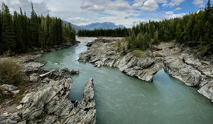
The Territory of Tsay Keh Dene Nation in northern British Columbia (B.C.) is a remote area, surrounded by an incredible diversity of landscapes, waterways and wildlife. The 3.2-million-hectare Territory of the Tsay Keh Dene is defined by river valleys and vast mountain ranges. In the Sekani language, their name means “people of the rocks.”
This area is also vulnerable to industrial development, a common story in B.C.’s natural resource-rich landscapes.
When the Province of B.C. built the W.A.C. Bennett Dam in the 1960s, the Peace, Parsnip, and Finlay Rivers were flooded to create the Williston Reservoir. The reservoir severed wildlife habitat, and displaced the Tsay Keh Dene from their homes in the valley — without notice. A recent film by Tsay Keh Dene Nation member, Luke Gleeson, details this devastating history.
To this day, the Tsay Keh Dene people, culturally important sites and wildlife species, and ecologically-intact landscapes face continuous threats from industry and climate change.
So, the Nation identified the need for a more holistic way to pinpoint priority areas for conservation in their Territory. This is where the work of one of Y2Y’s 2020 Sarah Baker Memorial Fund recipients, Chris Morgan, came into play.
Chris, now a master’s graduate from the University of Northern British Columbia (UNBC), compiled data and knowledge on climate change and interweaved this with Indigenous Knowledge in his “systematic conservation planning” project.
Tsay Keh Dene Nation, and Chu Cho Environmental, an environmental research and consulting company owned by Tsay Keh Dene Nation, were key partners on this collaborative project, along with other researchers at UNBC, including Y2Y board member Dr. Pamela Wright.
Decisions that support community and connectivity
This collaborative research can help empower the Nation to make defensible land-use decisions in the face of development proposals in Tsay Keh Dene Territory — useful for making decisions that support both biodiversity and the community’s needs.
“The main goal of this work was to benefit the Tsay Keh Dene Nation and the area they call home,” says Chris. “The Nation was truly the foundation of this project.”
By looking at the current picture of biodiversity, climate change and landscape connectivity in the region, the tool is a means of identifying climate resilient landscapes for protection, and evaluating industry proposals when needed.
Evan MacKinnon, director of the Tsay Keh Dene Nation Lands, Resources and Treaty Operations department, has emphasized that this research helps to “enshrine invaluable community knowledge in a data product that informs critical decision making on the landscape.”
The many layers of systematic conservation planning
The conservation planning tool is multi-faceted — it incorporates western science on climate change and conservation and interweaves this way of knowing with Indigenous Knowledge.
Chris developed data layers for different species, ecosystems and landscapes that are of high value for conservation. Three cultural layers were also provided by the Nation highlighting areas important to the Tsay Keh Dene for their spiritual and subsistence value.
Starting with a map of Tsay Keh Dene territory, the user can activate different data layers in the conservation planning tool to show which areas are most in need of protection. The outputs based on different scenarios are referred to as conservation “solutions.”
For example, the area outlined in light blue below was likely selected for its rare and diverse topography, carbon storage, and climate resilient habitat for wolverine, grizzly bears, and the Graham caribou herd.
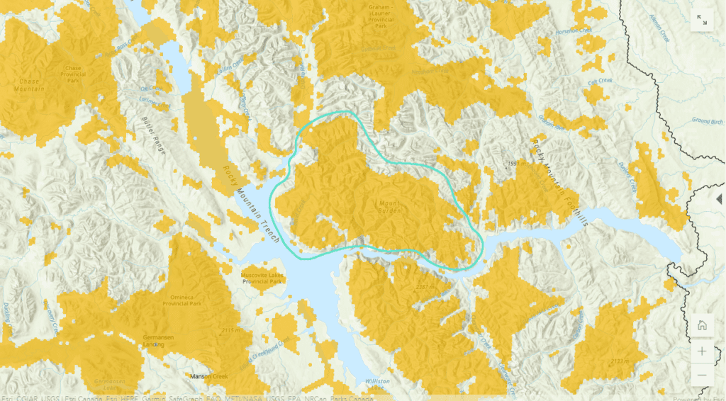
The conservation planning tool also identifies possible changes in this landscape. For example, an area dominated by spruce, willow, and birch trees today may become cedar and hemlock by the 2080s — an ecosystem not found anywhere in the territory today. This information can help make planning decisions that consider possible changes.
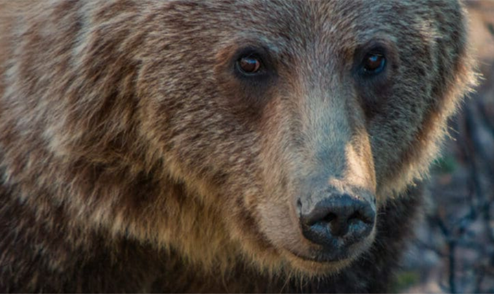
Erica Bonderud, a wildlife biologist with Chu Cho Environmental, says the planning tool has helped inform two research projects in Tsay Keh Dene Nation Territory. For one, the connectivity analysis was used to help identify possible movement corridors for grizzly bears, which are now being verified through a camera trap study.
“Understanding which movement paths grizzly bears are using within the Territory will allow for targeted habitat stewardship measures to be developed to ensure this species can safely navigate the land in the face of future habitat disturbances,” says Erica.
Data from the conservation planning tool has also been useful for looking at bird species, potential biodiversity hotspots, and the health of watersheds in supporting those species.
Protecting lifeways for people and wildlife
The outcomes of this project also highlight how conservation decisions within Tsay Keh Dene Territory can fit into the larger landscape puzzle — both in the Yellowstone to Yukon region and beyond.
“Smart planning and thoughtful decisions need to be made to protect places important for both people and wildlife,” says Chris. “I was glad to learn that Chu Cho Environmental combined my connectivity analyses with Indigenous Knowledge on known grizzly bear areas.”
The Nation has also used the connectivity analysis to help refine some of the boundaries of the Ingenika Indigenous Protected and Conserved Area, declared by the Tsay Keh Dene in 2020. Now, the hope is that this tool can continue to be used across the territory.
“The Peace region has been heavily impacted by dam reservoirs and resource extraction, making it the connectivity ‘pinch point’ in the Yellowstone to Yukon region,” says Candace Batycki, Y2Y’s B.C. program director. “Indigenous Protected Areas are protecting the remaining lifeways for people and wildlife, and we at Y2Y are grateful.”
Indigenous-led conservation can save biodiversity in B.C.
Indigenous Peoples, including members of Tsay Keh Dene Nation, are leading the way on conservation — their knowledge and leadership are crucial in preserving nature in the face of climate change and biodiversity loss.
Klinse-Za Provincial Park, where successful caribou recovery is taking place by the West Moberly and Saulteau First Nations, in collaboration with the federal and provincial governments was one of the best selected “solutions” based on what the conservation planning tool showed.
In Tsay Keh Dene Territory, the Ingenika Indigenous Protected and Conserved Area also exemplifies the kind of protection that will help preserve this region for future generations. This critical watershed is home to woodland caribou and many other sensitive wildlife.
This conservation planning tool could eventually help identify additional Indigenous Protected Areas in the region.
“As more and more Indigenous communities assert conservation solutions in their territories, tools that weave science and Indigenous Knowledge will be critical for decision-making and long-term planning. This is land-based reconciliation in action.”
Candace Batycki, Y2Y B.C. program director
“As more and more Indigenous communities assert conservation solutions in their territories, tools that weave science and Indigenous Knowledge will be critical for decision-making and long-term planning,” adds Batycki. “This is land-based reconciliation in action.”
Y2Y is both honored and proud to provide support to the Nations’ efforts to help make these Indigenous-led protected areas a reality. Supporting early-career researchers’ work that provides tangible conservation solutions such as Chris’ are integral to this success.
Learn more about the research in this February 2021 article.
About the Sarah Baker Memorial Fund
The Sarah Baker Memorial Fund supports science by early-career researchers that advance Y2Y’s conservation strategy and result in tangible benefits within the region. Sarah Jocelyn Baker’s appreciation for the natural world and ability to find solutions resonate with the aspirations and vision of Y2Y. We are honored to carry her spirit forward through the Sarah Baker Memorial Fund. Thanks to a gift from her extended family, Y2Y can offer grants to post-secondary students and postdoctoral fellows pursuing environmentally related studies at post-secondary institutions in Canada or the United States.